Vegetation Departure
We are developing another section of this training site that will be entirely devoted to vegetation departure. This section is intended to give you the basics.
What you will find in this section
An overview of the Vegetation Departure data
Key attributes of the Vegetation Departure data
Where to find Vegetation Departure data
Ways to use the Vegetation Departure data
Some misconceptions about the Vegetation Departure metric
LANDFIRE’s Vegetation Departure metric
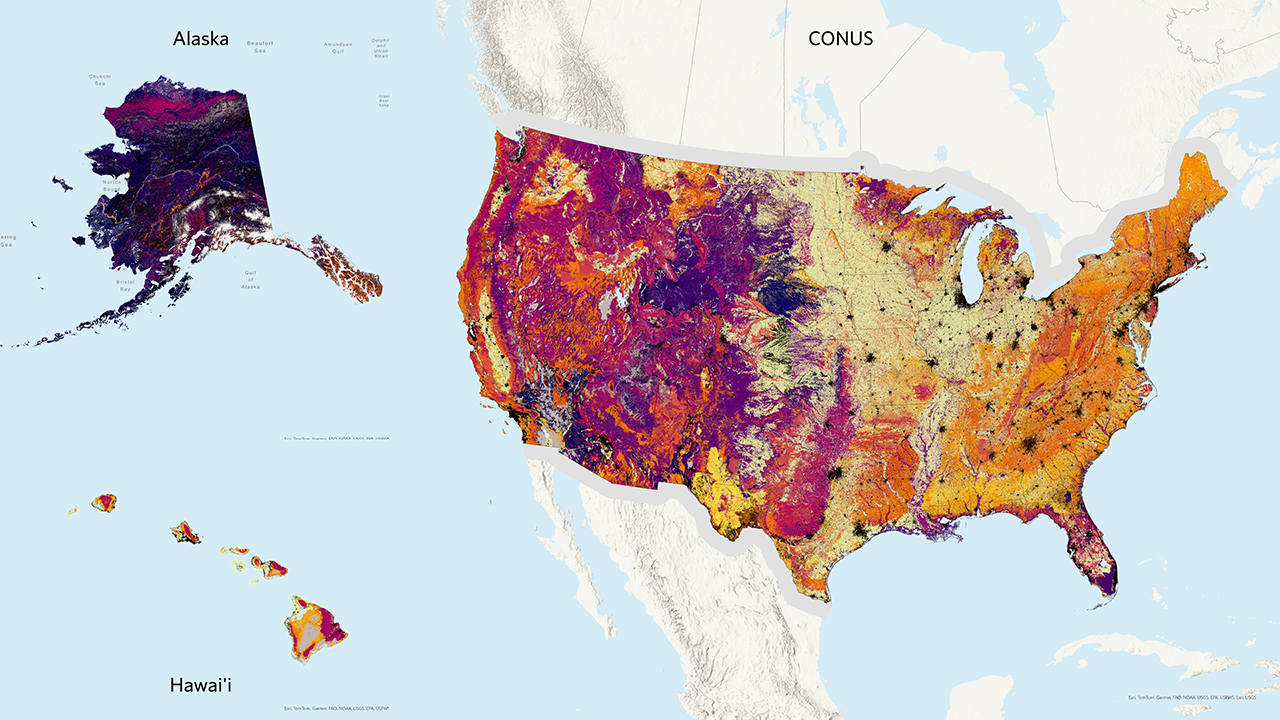
The Vegetation Departure (VDep) metric from LANDFIRE measures how current vegetation on a landscape differs from expected historical conditions. This difference is assessed based on changes in vegetation composition, structural stage, and canopy closure. VDep values range from 0 to 100, with higher values indicating greater departure from historical conditions. It’s important to note that VDep is scale-dependent, meaning it can vary across different landscape units.
VDep is calculated using current vegetation data and reference conditions that are based on the BpS models. These models represent a pre-European colonization time period and are updated periodically. As a result of these periodic updates to BpS models and changes in existing vegetation, VDep values can change with each new version of LANDFIRE data. However, caution is advised when comparing VDep values across different versions due to potential differences in the underlying data and methods used.
LANDFIRE uses several datasets to calculate and map vegetation departure. First, the Biophysical Settings map is combined with the Succession Class map to calculate the current amount of each succession class within a BpS. Next, the current amount is compared to the reference amount provided in the reference conditions table. Finally, the value of VDep is calculated following methods in the Fire Regime Condition Class Guidebook (opens a pdf).
Over the years, the methodology for calculating VDep has evolved to better suit LANDFIRE’s needs. You can find a chart with more specifics around the VDep methodology on the Vegetation Departure Page of the LANDFIRE Program website.
Where to find the Vegetation Departure data
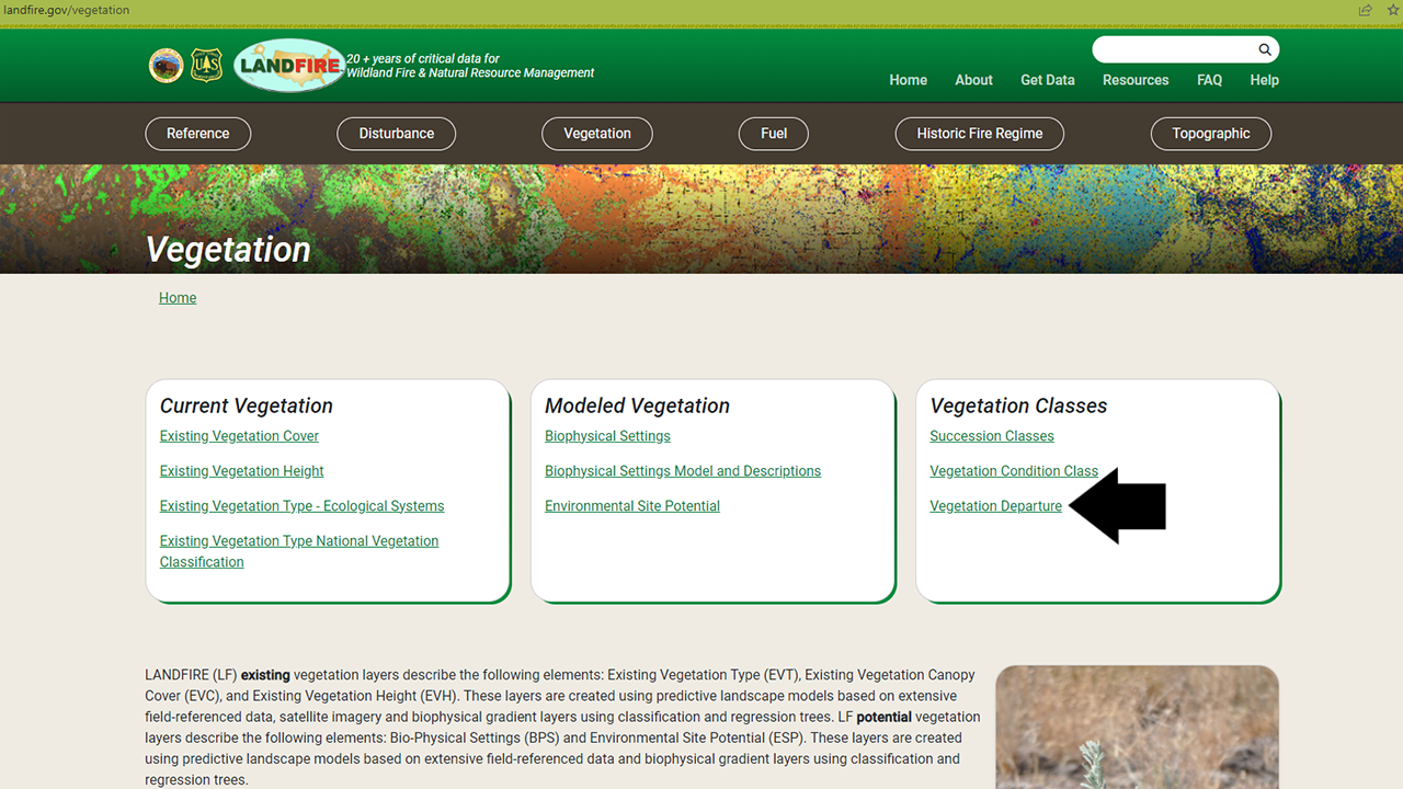
The Vegetation Departure data are included in the Vegetation section of the LANDFIRE Program Website on the Vegetation Departure page.
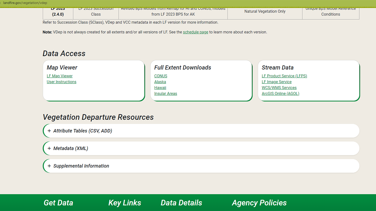
On that page you will find an overview, including the information above along with further details and links to other important documents. Perhaps of most interest are the download links - via the LANDFIRE Map Viewer, full extent downloads, and a variety of ways to stream data into your maps. The page also includes resources such as attribute tables, metadata, and supplemental information.
In a later section of this site, you will learn more about the differences between these download methods and how to access data via each method.
Screenshots of Data Access and Resources on the Vegetation Departure page
How does the Vegetation Departure metric help?
The most common application of the Vegetation Departure metric is evaluating overall vegetation condition using a numerical score between 1 and 100. The score is useful for comparing conditions on different landscapes. VDep can also provide insight into management needs for a specific BpS. By using the appropriate reference conditions, a user can determine which seral states are overrepresented, underrepresented, or well represented on the landscape. This provides useful information on where/how to focus management activities to achieve the desired result. Examples include the Ecological Conservation Risk Index, Landscape Conservation Forecasting, the USFS Watershed Condition Class metric (opens a pdf), and the USFS Terrestrial Condition Assessment.
Customizing the Vegetation Departure metric
Swaty, et al. (2022) describes the vegetation departure metric’s calculation, its application by LANDFIRE, and provides case studies to illustrate its use in assessing ecosystem health and guiding management decisions. They also provide several ways to customize the VDep metric to make it more relevant to local conditions and specific conservation goals, including:
Reference Conditions: Users can define reference conditions based on any baseline of interest, which can represent historical, current, or desired future conditions. This flexibility allows the VDep metric to be tailored to specific conservation objectives or local ecological contexts.
Input Data: The paper emphasizes the importance of using thematically consistent input data. Users are encouraged to review and modify existing data sets to ensure they meet their specific needs. This might involve aggregating or splitting ecosystem types to achieve the desired level of detail.
Current Conditions: Customizing the current condition inputs can include defining structural stages based on various attributes such as species composition, canopy cover, vegetation height, tree diameter, or stand age. This may allow for a more accurate representation of current conditions when high quality, local datasets are available.
Summary Unit: The size and boundaries of the summary unit, which is the area over which VDep values are computed, can be adjusted. This ensures that the summary unit is ecologically meaningful and captures the full suite of structural stages in their reference proportions
Local Calculation: By calculating VDep, locally, users can customize inputs to increase local relevancy. This includes setting locally meaningful reference values that may reflect a desired future condition rather than historical conditions.
These customizations help make the VDep metric a more precise and useful tool for assessing ecosystem conditions and informing management decisions in diverse ecological settings.
Enhancing the Vegetation Departure for Conservation Risk Assessment
Provencher, et al., 2024 detail how vegetation departure can be utilized to assess and manage risks to biodiversity and ecosystem health. They outline several key methods and considerations for applying the VDep metric in conservation contexts, including:
Risk Identification: The metric helps identify areas where current vegetation conditions significantly differ from reference states, indicating potential threats to ecological integrity.
Temporal Variability Considerations: While temporal variability within replicate samples is not used, the authors underscore the importance of considering long-term trends in data collection and analysis.
Custom Reference Points: Users are guided on setting custom reference points that reflect both historical and desired future conditions, aiding in the identification of areas requiring conservation actions.
Risk Prioritization: By adjusting summary units based on ecological significance, users can better prioritize risk management efforts across different scales.
These methodologies enhance the VDep metric’s applicability for evaluating and addressing conservation risks in varied ecological settings, providing a robust framework for informed decision-making in natural resource management.
Common misconceptions about the Vegetation Departure metric
Myth: VDep is a static metric.
Reality: The final VDep value depends on the summary unit you utilized in the calculation (see Swaty, et al. (2022)). It is important to understand what summary unit is most suited to your particular situation.
Myth: Reference Conditions are about the past.
Reality: Reference Conditions can be about past patterns, but this is not required. Reference Conditions are not tied to any particular time period, and they can be adjusted by users.
Myth: VDep can be used on small areas.
Reality: VDep is generally not useful for small areas because a key assumption of the metric is that the summary unit is large enough to possibly contain all seral states.
Myth: VDep is Fire Regime Condition Class
Reality: In early LANDFIRE versions the VDep layer was called Fire Regime Condition Class (FRCC) but that was not correct. FRCC is a two-dimensional metric that incorporates Vegetation Departure (VDep) and Fire Regime Departure. LANDFIRE has never included information on Fire Regime Departure, so the name of the product was changed to VDep.
Helpful Resources
Vegetation Departure Workshop video series on the LANDFIRE YouTube channel (opens a 13 video YouTube playlist)
The Fire Regime Condition Class Guidebook (opens a pdf)
Assessing Ecosystem Condition: Use and Customization of the Vegetation Departure Metric by Swaty, et.al (2022)
The USFS Watershed Condition Class metric (opens a pdf)
The USFS Terrestrial Condition Assessment
Still have questions? LANDFIRE is here to help.
Ask the LANDFIRE Helpdesk (email link).
Search and subscribe to the LANDFIRE YouTube Channel (see tutorials, Office Hours, quick demonstrations).
Join an Office Hour (monthly meeting with open format Q & A with LANDFIRE experts).
Schedule a meeting (email link) with TNC’s LANDFIRE Team.