Existing Vegetation Height
For the most up-to-date information on each LANDFIRE data product, please view the individual product pages on the LANDFIRE Program website.
What you will find in this section
An overview of the Existing Vegetation Height data
Key attributes of the Existing Vegetation Height data
Where to find Existing Vegetation Height data
Common uses for Existing Vegetation Height data
Existing Vegetation Height
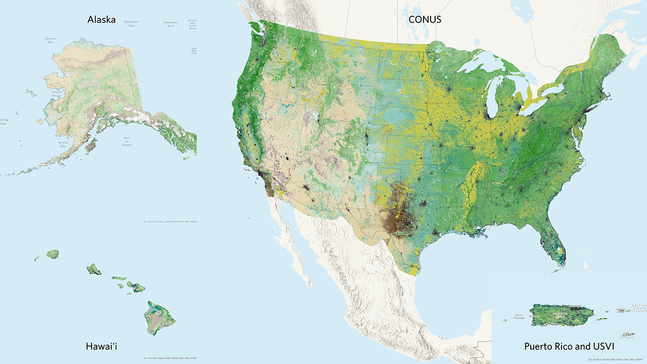
LANDFIRE’s Existing Vegetation Height dataset, also known as EVH, works in tandem with the Existing Vegetation Type dataset to give a more detailed picture of the current vegetation on a landscape. EVH represents the average height of the dominant vegetation for a 30-m cell.
EVH is generated separately for tree, shrub, and herbaceous cover lifeforms using training data and other geospatial layers. Decision tree relationships are used to generate lifeform specific height class layers, which are merged into a single composite EVH layer. Only the EVH for the primary upper layer lifeform is included in each pixel. For more information on how EVH was created, review the Technical Documentation provided on the LANDFIRE program website.
LANDFIRE uses EVH in several subsequent layers, including the development of the fuels products and Succession Classes.
Key EVH Attributes include:
- CLASSNAMES: The main attribute of EVH. This combines the EVT lifeform with the average height of the dominant lifeform. Key lifeforms are described below. As with all LANDFIRE layers, you can get more information about individual attributes from the EVH Attribute Data Dictionary (opens a pdf).
- Tree Height: average tree height in meters
- Shrub Height: average shrub height in meters
- Herb Height: average herb/grass height in meters
- Developed-Upland Vegeatation: Five classes of developed upland vegetation
- Developed: Seven classes of developed landscapes
- Developed-Roads: Pixels identified as roads
- Agriculture: Several classes of cropland and other agricultural land
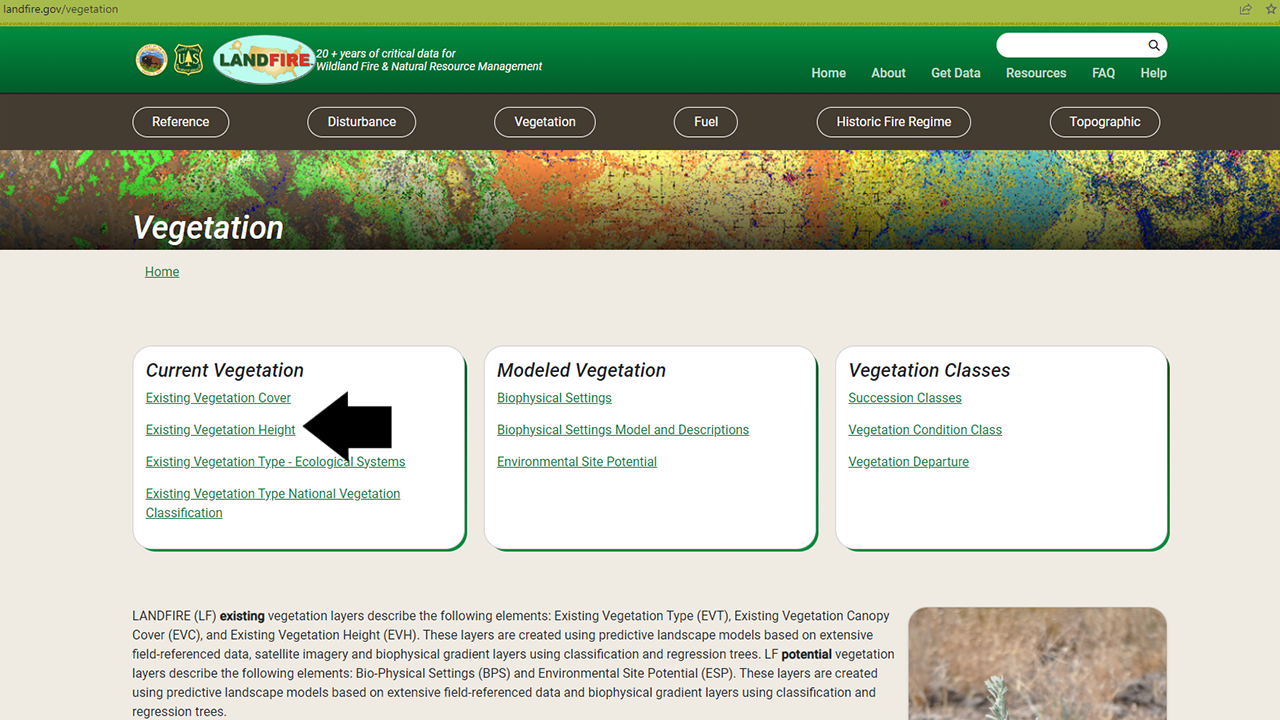
Where to find Existing Vegetation Height data
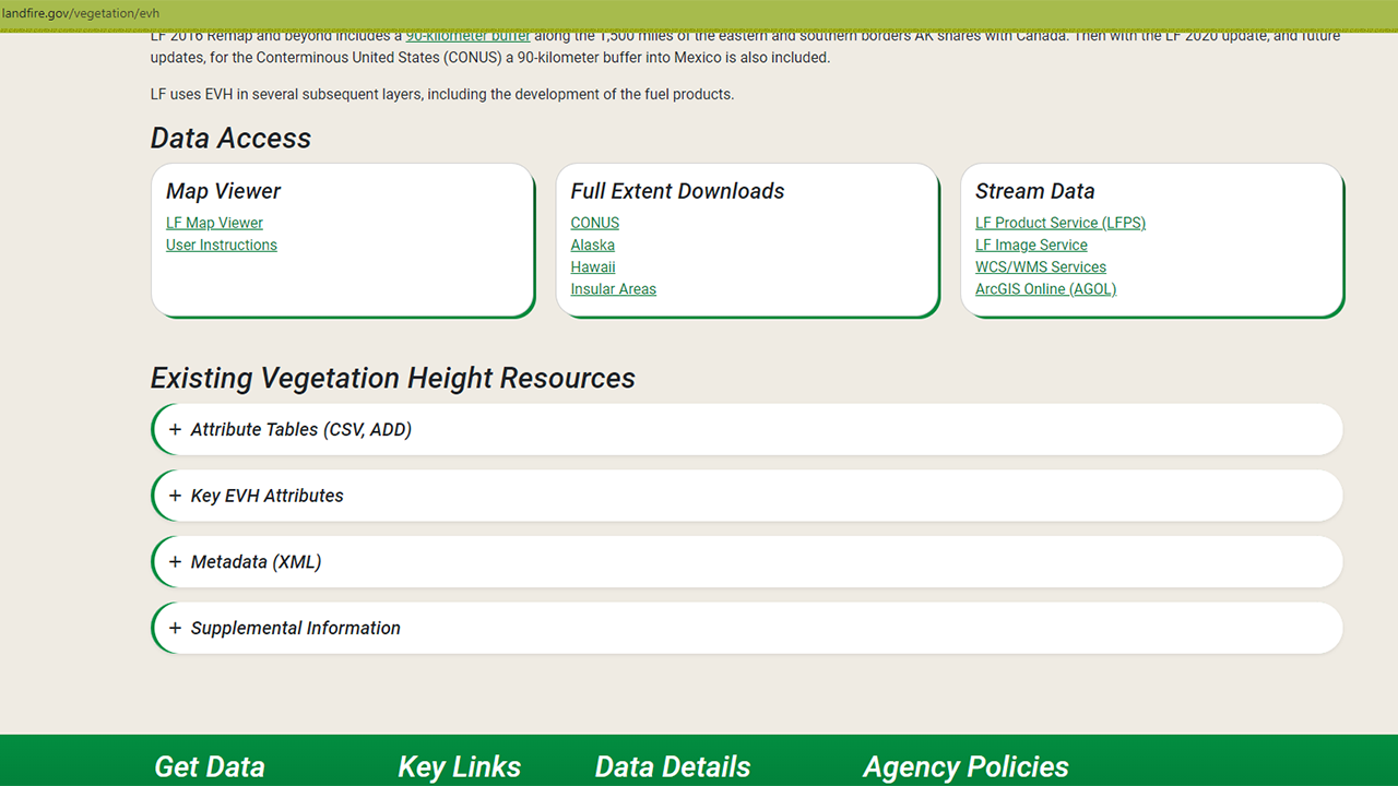
The Existing Vegetation Height data is included in the Vegetation section of the LANDFIRE Program Website on the Existing Vegetation Height page.
On that page you will find an overview, including the information above along with further details and links to other important documents. Perhaps of most interest are the download links - via the LANDFIRE Map Viewer, full extent downloads, and a variety of ways to stream data into your maps. The page also includes resources such as attribute tables, metadata, and supplemental information.
In a later section of this site, you will learn more about the differences between these download methods and how to access data via each method.
Screenshots of Data Access and Resources on the Existing Vegetation Height page
Some uses for Existing Vegetation Height data
EVH can be used to simply map and quantify vegetation height. This is done by clipping the data to your landscape of interest. Even more simple is to bring the data into GIS and view it! We can learn a lot about a place by simply exploring in GIS software.
In addition to basic viewing, mapping, and quantifying of ecosystems using the EVH dataset, this data also supports various analyses and operations, such as:
Heeren et al., (2023) developed a model to map wildfire structure defensibility, using LANDFIRE Existing Vegetation Height (and other LANDFIRE) datasets. As delivered, the dataset represents the average height of a lifeform. The authors did not need lifeform, so they modified the data to represent one continuous height dataset that did not have herbaceous, shrub or tree modifiers.
In an exploration of how targeted cattle grazing might impact vegetation of a wetland habitat area, Balaji et al., (2023) (opens a pdf) of a NASA Develop team used different versions of the EVH dataset. Coupled with other datasets they were able to detect changes in vegetation due to grazing, and to develop a workflow for future monitoring.
Landscape Assessments: LANDFIRE-TNC often uses LANDFIRE EVH in combination with EVT and EVC to better understand landscapes using something we call landscape assessments. We will have a later section of this website specifically dedicated to how we create landscape assessments using GIS and R.
Succession Class: EVH, once again in combination with EVT and EVC, is a key component in the way LANDFIRE creates and maps succession class. Through Succession Class, EVH contributes to the calculation of Vegetation Departure and Vegetation Condition Class.
Helpful Resources
Existing Vegetation Height Attribute Data Dictionary (opens a pdf)
Mapping wildfire structure defensibility with LANDFIRE Existing Vegetation Height
Detecting changes in vegetation height (opens a pdf) due to grazing
Still have questions? LANDFIRE is here to help.
Ask the LANDFIRE Helpdesk (email link).
Search and subscribe to the LANDFIRE YouTube Channel (see tutorials, Office Hours, quick demonstrations).
Join an Office Hour (monthly meeting with open format Q & A with LANDFIRE experts).
Schedule a meeting (email link) with TNC’s LANDFIRE Team.